1
/
de
2
Victoria Cooper Antique Prints
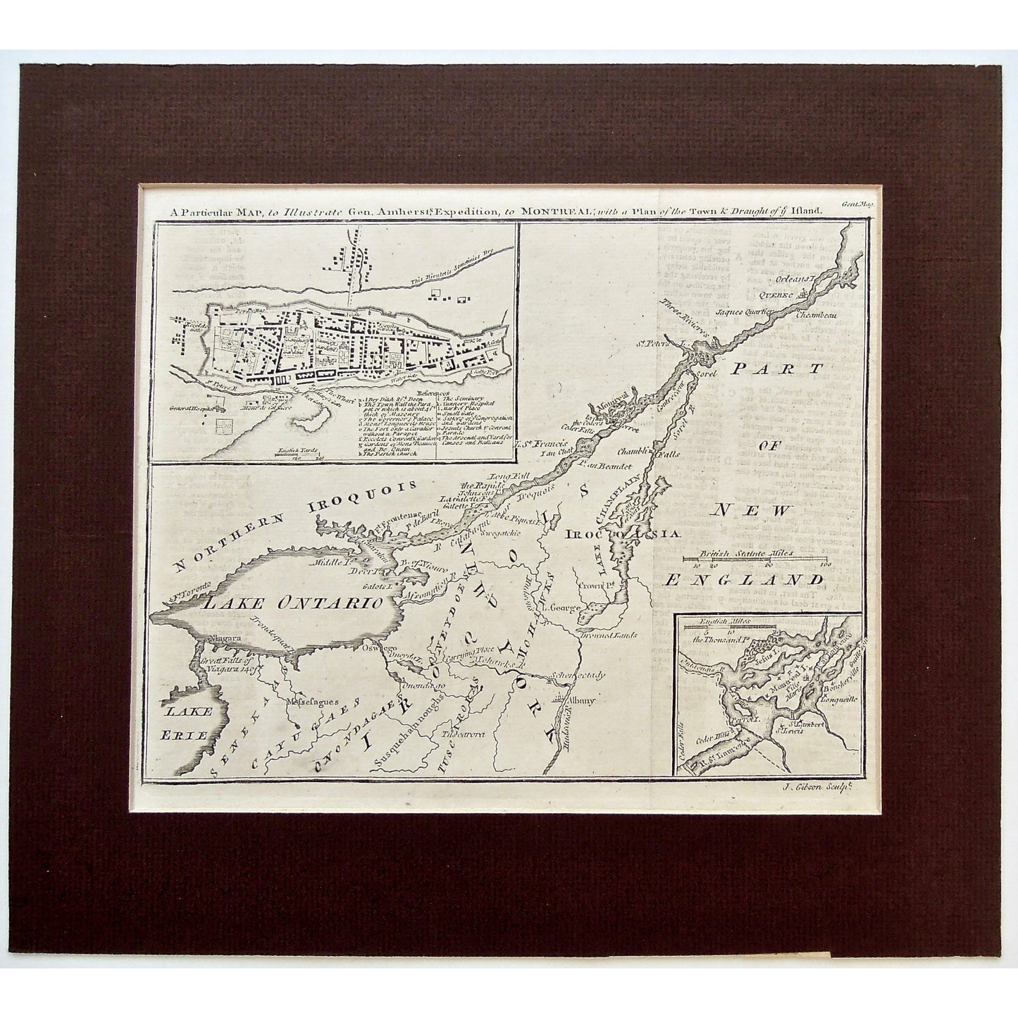
A Particular Map, to Illustrate Gen. Amherst's Expedition, to Montreal, with a Plan of the Town & Draught of ye Island. (S3-75b)
A Particular Map, to Illustrate Gen. Amherst's Expedition, to Montreal, with a Plan of the Town & Draught of ye Island. (S3-75b)
Prix habituel
$450.00 USD
Prix habituel
Prix promotionnel
$450.00 USD
Quantité
Impossible de charger la disponibilité du service de retrait
A Particular Map, to Illustrate Gen. Amherst's Expedition, to Montreal, with a Plan of the Town & Draught of ye Island.
Upper Right: Gent. Mag. Lower Right: J. Gibson Sculpt.
Source / Publication: Gentleman's Magazine
Date: October, 1760
Engraver: J. Gibson
Paper Dimensions: 8 1/8 x 10 inches.
Platemark Dimensions: 7 3/4 x 9 7/8 inches.
Medium: Copper Engraving
Language: English
Coloured: Black and white
Condition: The map is in great condition with very minimal wear around the edges, as can be seen.
Keywords: Particular Map, Map, Gen. Amherst, General Amherst, General Amherst's Expedition, Expedition to Montreal, Montreal, Expedition, Plan of the Town, Draught, Part of New England, New England, Orleans, Quebec, Jacques Cartier, Chambeau, Three Rivers, Trois Rivieres, Sorel, St. Peters Chamblis, Lake Champlain, Crown Point, Irocoisia, Iroquois, Long Fall, Lake St. Francis, La Galette, Cataraqui, Mohawk, Mohawks, New York, Native, Native American, Bay of nioure, Fort Frontenac, Frontenac, Fort, Lake George, Ville Marie, Longueille, St. Lawrence River, Schenectady, Albany, Hudson's River, Tuscaroras, Susquehannough, Tuscaron, Onondagaes, Cayugaes, Senekaas, Senecas, Oswego, Oneydoes, Assumption River, Onondago, Messesagues, Niagara Falls, Lake Erie, Lake Ontario, Northern Iroquois, Galots Island, Deer Island, Governor's Palace, Monsieur Longuevils House, De Quain, Beausott, Parish Church, Seminary, Nunnery Hospital, General Hospital, Jesuit Church, Aresnal, Yard for Canoes, Batteau, Map, Maps, Mapping, Chart, Charts, Charting, Boucherville, Guilleson, Jesus Island, Cedar Hills,
Price: US$450
Identification Number: S3-75b
Share


