1
/
de
2
Victoria Cooper Antique Prints
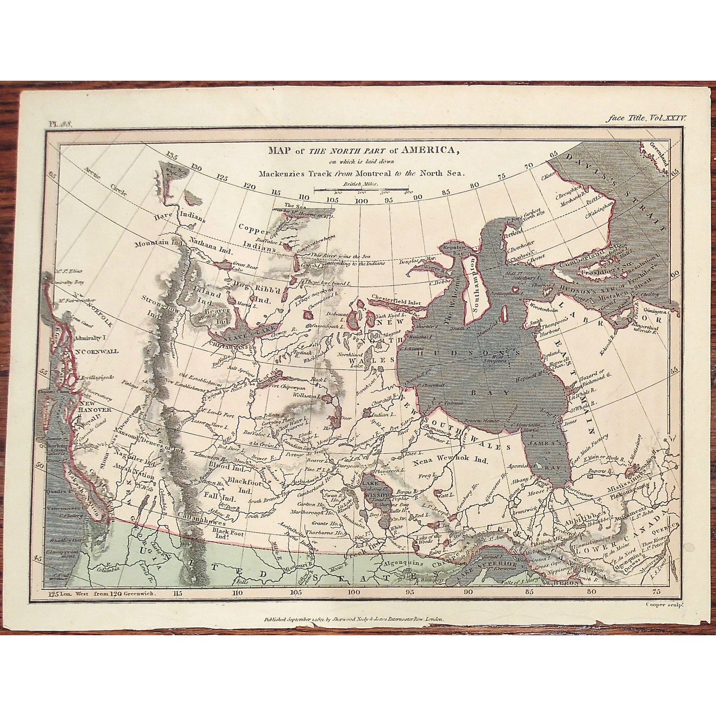
Map of the North Part of America, on which is laid down Mackenzies Track from Montreal to the North Sea. (S3-37)
Map of the North Part of America, on which is laid down Mackenzies Track from Montreal to the North Sea. (S3-37)
Prix habituel
$145.00 USD
Prix habituel
Prix promotionnel
$145.00 USD
Prix unitaire
/
par
Impossible de charger la disponibilité du service de retrait
Map of the North Part of America, on which is laid down Mackenzies Track from Montreal to the North Sea.
Upper Left: Pl. 88. Upper Right: face Title. Vol. XXIV. Lower Center: Published September 1.1821. by Sherwood Neely & Jones Paternoster Row, London. Lower Right: Cooper sculpt.
Publisher: Sherwood Neely & Jones
Place of Publication: Paternoster Row, London
Date: September 1st, 1821
Volume: 24
Plate Number: 88
Engraver: Cooper
Paper Dimensions: 8 1/4 x 10 1/2 inches.
Medium: engraving
Language: English
Coloured: Coloured
Condition: The print is in great condition with some minor wear along the bottom and the top of the print, as can be seen.
Keywords: Map, North America, North Part of America, Mackenzie's Track, Montreal, North Sea, Hudson's Bay, Labrador, Hudson's Strait, Davis Strait, Nena Wehok Indians, Copper Indians, Dog Ribbed Indians, Mountain Indians, Strongrow Indians, Fall Indians, Cattanahowes, New Georgia, New South Wales, New North Wales, Lower Canada, Upper Canada, Great Lakes, East Main, Stony Mountains, Wakash Nation, Lake Winnipic, Blood Indians, Blackfoot Indians, Nagailer Indians, Atnah Nation, Slave Lake, Chepawyans, Beaver Indians, Hare Indians, Copper Indians, Inland Indians, Indian Land, Native American, Creek Indians,
Price: US$145
Identification Number: S3-37
Share


