1
/
de
2
Victoria Cooper Antique Prints
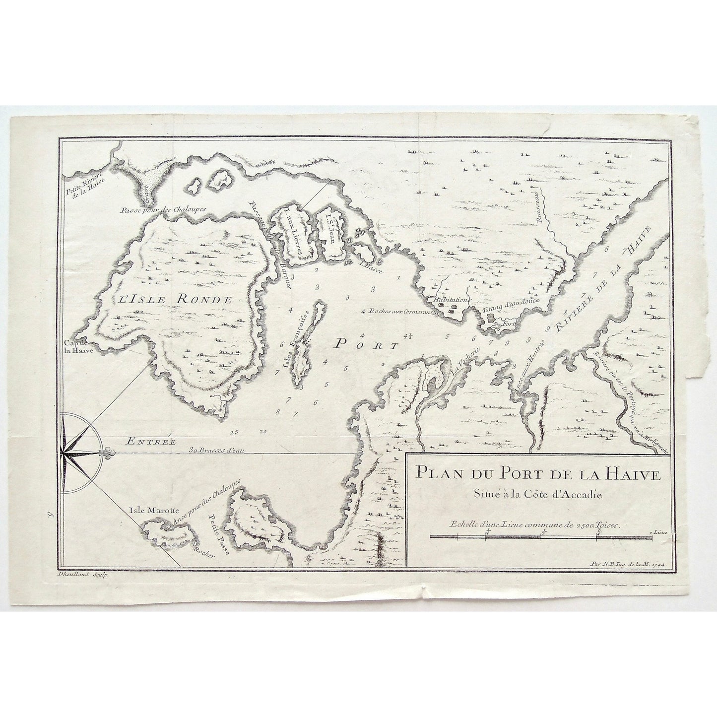
Plan Du Port de la Haive Suite a la Cote D'Accadie. Par N.B.Ing. de la M. 1744. (S3-61)
Plan Du Port de la Haive Suite a la Cote D'Accadie. Par N.B.Ing. de la M. 1744. (S3-61)
Prix habituel
$300.00 USD
Prix habituel
Prix promotionnel
$300.00 USD
Prix unitaire
/
par
Impossible de charger la disponibilité du service de retrait
Plan Du Port de la Haive Suite a la Cote D'Accadie. Par N.B.Ing. de la M. 1744.
Lower Left: 5. Dheulland Sculp.
Author: Pierre François Xavier de Charlevoix (1682-1761)
Source / Publication: Histoire et Description Generale de la Nouvelle France avec Le Journal Historique d'un Voyage fait par Ordre du Roi dans L'Amérique Septentrionnale.
Publisher: Chez Rollin Fils
Place of Publication: Quai des Augustins, à Saint Athanase, & au Palmier, Paris
Date: 1744
Volume: 4
Page Number: Between 56-57
Artist: Jacques-Nicolas Bellin (1703-1772)
Engraver: Guillaume Dheulland (1700-1770)
Paper Dimensions: 8 3/4 x 12 3/8 inches.
Platemark Dimensions: 8 1/4 x 11 3/4 inches.
Medium: Copper engraving
Language: French
Coloured: Black and white
Condition: The map is in good good overall condition with some wear around the edges including a few small, clean tears into each of the sides of the map; as well as the right side of the map being uneven, as can be seen.
Keywords: Plan du Port de la Haive, Plan, Port de la Haive, Riviere de la Haive, La Haive, à côte d'Accadie, l'Accadie, Ance aux huitres, Port, Fort, isle Marotte, Ance pour des Chaloupes, Isle Ronde, Cape de la Haive, Isle aux Liévres, Isle st. Jean, Isles Françoises, Habitations, Roches aux Cormorans, Isle Basse, Compass, Nicolas Bellin, Jacques Nicolas Bellin, Charlevoix, 1744, Ingenieur Marine, Marine Engineer, Dheulland, Map, Maps, Mapping, Chart, Charts, Charting,
Price: US$300
Identification Number: S3-61
Share


