1
/
de
2
Victoria Cooper Antique Prints
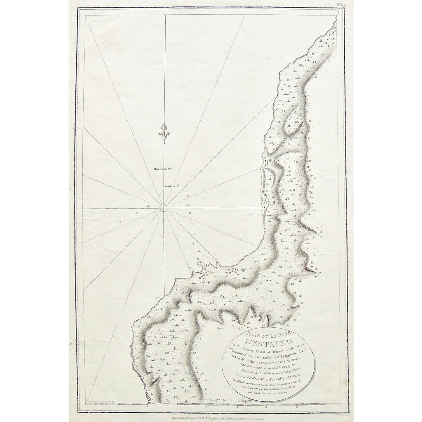
Plan of La Baie d'Estaing on the Eastern Coast of Tchoka in 48. 59' 38". Of Latitude North and 140.0'42" of Longitude East taken from the Anchorage of the Astrolabe. ... (S3-83)
Plan of La Baie d'Estaing on the Eastern Coast of Tchoka in 48. 59' 38". Of Latitude North and 140.0'42" of Longitude East taken from the Anchorage of the Astrolabe. ... (S3-83)
Prix habituel
$185.00 USD
Prix habituel
Prix promotionnel
$185.00 USD
Quantité
Impossible de charger la disponibilité du service de retrait
Plan of La Baie d'Estaing on the Eastern Coast of Tchoka in 48. 59' 38". Of Latitude North and 140.0'42" of Longitude East taken from the Anchorage of the Astrolabe. This Bay was discovered 20 July 1787, by the Boussole & Astrolabe commanded by Messrs. De la Perouse and De Langle. The Needle experienced no variation. The bottom where the soundings are marked is Sand, Mud & Shells. The whole Bay was not sounded.
Upper Right: No. 51. Lower Center: Published as the Act directs Novr. 1st, 1798 by G.G.&J.Robinson, Paternoster Row, London. Lower Right: Neele sc. Strand.
Author: La Pérouse, Jean-François de Galaup, comte de, (1741-1788)
Source / Publication: Charts And Plates To La Perouse's Voyage. Published as the Act directs Novr. 1st 1798
Publisher: G.G. & J. Robinson
Place of Publication: Paternoster Row, London
Date: November 1st, 1798
Date (Depicted): 1787
Page Number: 51
Artist: La Pérouse, Jean-François de Galaup, comte de, (1741-1788)
Engraver: S. J. Neele
Paper Dimensions: 17 3/4 x 11 1/4 inches.
Platemark Dimensions: 15 7/8 x 10 1/4 inches.
Coordinates: 48. 59' 38". Of Latitude North and 140.0'42" of Longitude East
Medium: Copper engraving
Language: English
Coloured: Black and white
Condition: The print is in great condition with some wear around the edges, including a small tear in the paper on the left side, as well as a couple of tears into the left side and another tear into the right side of the print, as can be seen. There are also some minor, faint crease marks across the top right corner of the print, as can be seen.
Keywords: Boussole, Astrolabe, Plan, Plan of La Baie d'Estaing, Baie d'Estaing, Village, Eastern Coast, Tchoka, Anchorage, La Perousse, De Langle, G.G. & J. Robinson, Paternoster Row, london, Map, Maps, Mapping, Chart, Charting, Coastline, Charts, Russia,
Price: US$185
Identification Number: S3-83
Share


