1
/
de
2
Victoria Cooper Antique Prints
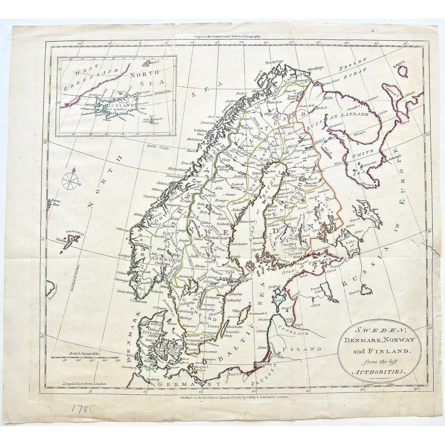
Sweden, Denmark, Norway and Finland from the best Authorities. Inset: West Greenland. Iceland. (S3-51)
Sweden, Denmark, Norway and Finland from the best Authorities. Inset: West Greenland. Iceland. (S3-51)
Prix habituel
$220.00 USD
Prix habituel
Prix promotionnel
$220.00 USD
Quantité
Impossible de charger la disponibilité du service de retrait
Sweden, Denmark, Norway and Finland from the best Authorities.
Inset: West Greenland. Iceland. Upper Center: Engrav'd for Guthrie's New System of Geography. Lower Center: Published as the Act Directs January 1st 1785, by C. Dilly & G. Robinson London.
Source / Publication: Guthrie's New System of Geography
Publisher: C. Dilly & G. Robinson
Place of Publication: London
Date: January 1st, 1785
Paper Dimensions: 14 5/8 x 16 inches.
Platemark Dimensions: 13 1/2 x 15 inches.
Medium: Copperplate engraving
Language: English
Coloured: Coloured outline
Condition: The print is in good condition with some wear around the edges, including two clean tears into the top of the print, one into the bottom of the print and a bit larger of a tear into the right side of the print, as can be seen. The tear on the right side, had previously been taped on the back; however, the tape has come off.
Keywords: Sweeden, Denmark, Norway, Finland, West Greenland, Greenland, North Sea, Iceland, Arctic circle, Frozen ocean, Russia in Europe, Russia, Europe, North Sea, Baltic Sea, Poland, Courland, Gulf of Finland, Germany, Prussia, White Sea, Lapland, Russian Lapland, Lake of langdon, Lake Omega, Drontheim, Sgerhus, Gothland, Gulf of Bothnia, Gulf of Bosnia, West Bothnia, East Bothnia, Bosnia, Bergen, Stockholm, Jutland, Schonen, Kelgoy Island, Pepus Lake, 1785, C. Dilly, Dilly, G. Robinson, Robinson, London, Guthrie's New System of Geography, Guthrie, Guthrie's, New System of Geography, Map, Mapping, Maps, Chart, Charts, Charting, Copperplate, Engraving, Copper, January 1st 1785, Antique Map, Antique Print, Antique Maps, Antique Charts, Vintage Maps, Vintage Charts, Rare, Collectible, Wall art, Wall decor, Design, Colored outline,
Price: US$220
Identification Number: S3-51
Share


