-
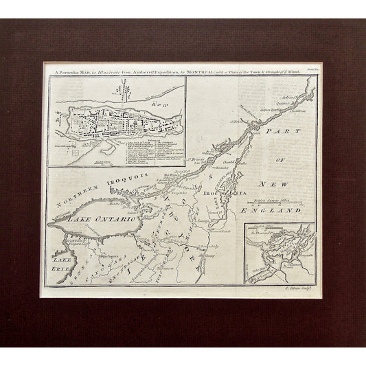
A Particular Map, to Illustrate Gen. Amherst's Expedition, to Montreal, with a Plan of the Town & Draught of ye Island. (S3-75b)
Regular price $450.00 USDRegular price -
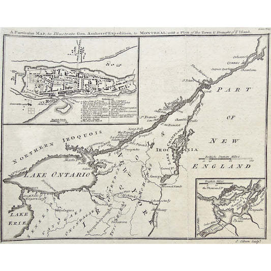
A Particular Map, to Illustrate Gen. Amherst's Expedition, to Montreal, with a Plan of the Town & Draught of ye Island. (S3-75a)
Regular price $450.00 USDRegular price -
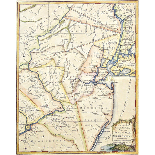
A New and Accurate Map of the Present Seat of War in North America, Comprehending New Jersey, Philadelphia, Pensylvania, New-York, &c. (S3-74)
Regular price $180.00 USDRegular price -
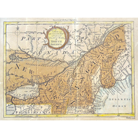
Seat of War in North America. (S3-73)
Regular price $180.00 USDRegular price -
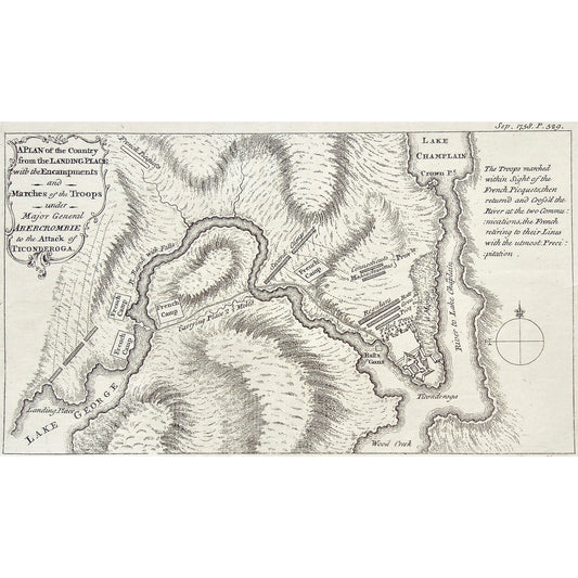
A Plan of the Country from the Landing Place with the Encampments and Marches of the Troops under Major General Abercrombie to the Attack of Ticonderoga. (S3-71)
Regular price $320.00 USDRegular price -
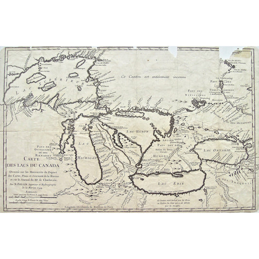
Carte des Lacs du Canada. Dressée sur les Manuscrits du Depost des Cartes, Plans et Journaux de la Marine et sur le Journal du RP. de Charlevoix. Par N. Bellin Ingenieur et Hydrographe de la Marine 1744.(S3-67)
Regular price $850.00 USDRegular price -
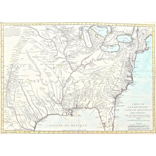
Carte de la Louisiane cours du Mississipi et pais voisins. Dediée à M. le Comte de Maurepas, Ministre et Secretaire de État Commandeur des Ordres du Roy. Par N. Bellin, Ingenieur de la Marine, 1744. (S3-66)
Regular price $1,800.00 USDRegular price -
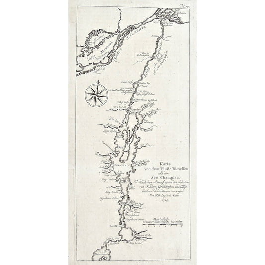
Karte von dem Flusse Richelieu und dem See Champlain, Nach den Manuscripten des Schatzes von Karten Grundriven und Tage büchern der Marime entworfen. Von N.B. Ingr. de la Marine 1744. (S3-64)
Regular price $325.00 USDRegular price -
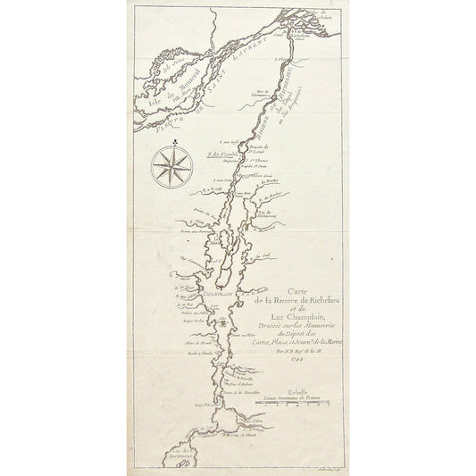
Carte de la Rivière de Richelieu et du Lac Champlain, Dressée sur les Manuscrits du Dépost des Cartes, Plans, et Journx. de la Marine. Par N.B. Ingr. de la M. 1744. (S3-63)
Regular price $350.00 USDRegular price -
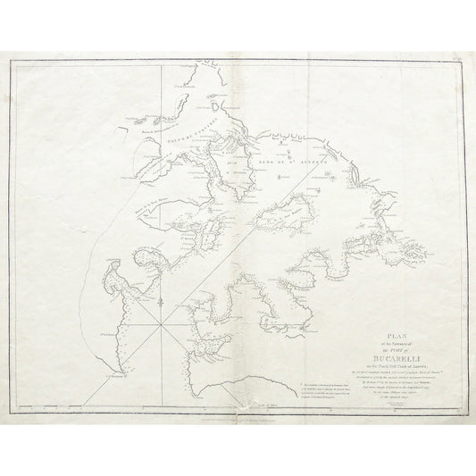
Plan of the Entrance of the Port of Bucarelli on the North West Coast of America, in 55'.15' of Latitude North & 136'.15' of Longitude West of Paris: Discovered in 1775 by the Spanish Schooner La Senora ... (S3-89)
Regular price $400.00 USDRegular price -
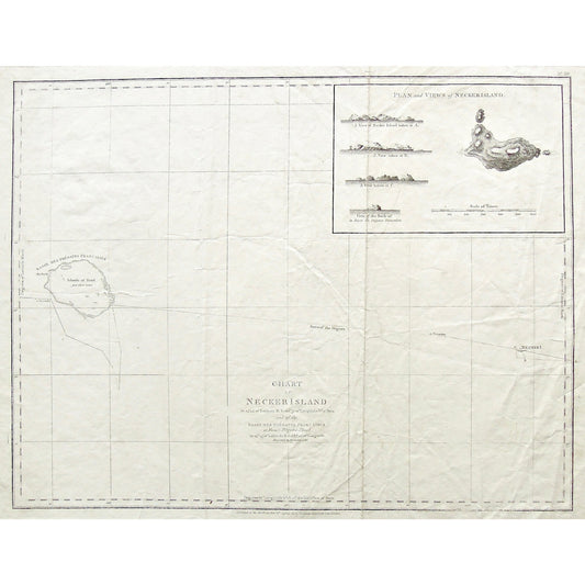
Chart of Necker Island in 23'.34' of Latitude N. & 166'.52 of Longitude W. of Paris and of the Basses des Frégates Francaises or French Frigates Shoal, in 23'.45' of Latitude N. & 168'.10' of Longitude. Discovered in November 1786. (S3-88)
Regular price $325.00 USDRegular price -
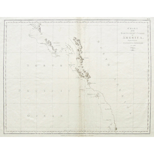
Chart of the North west Coast of America, Explored by the Boussole & Astrolabe in 1786. 2d. Sheet. Neele Sc. Strand. (S3-87)
Regular price $325.00 USDRegular price -
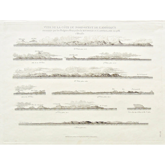
Vues de la Côte du Nord-ouest de l'Amérique reconnue par les Frégates Françaises la Boussole et l'Astrolabe en 1786. 2e feuille. (S3-84)
Regular price $235.00 USDRegular price -
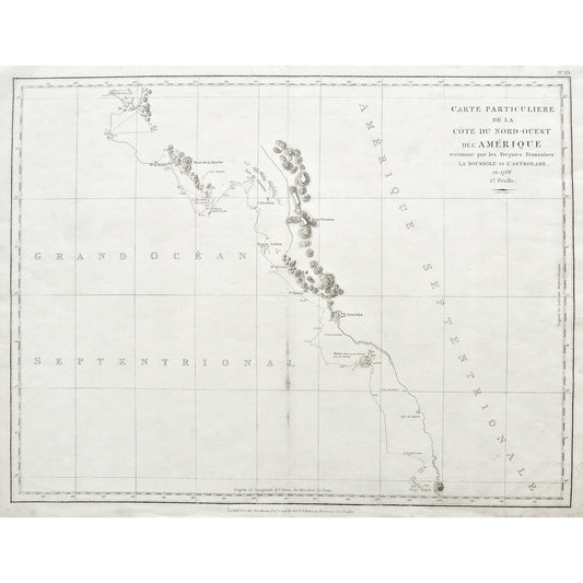
Carte particuliere de la Côte du Nord-Ouest de l'Amérique reconnue par les Frégates Françaises la Boussole et l'Astrolabe en 1786. 2e Feuille. (S3-82)
Regular price $425.00 USDRegular price -
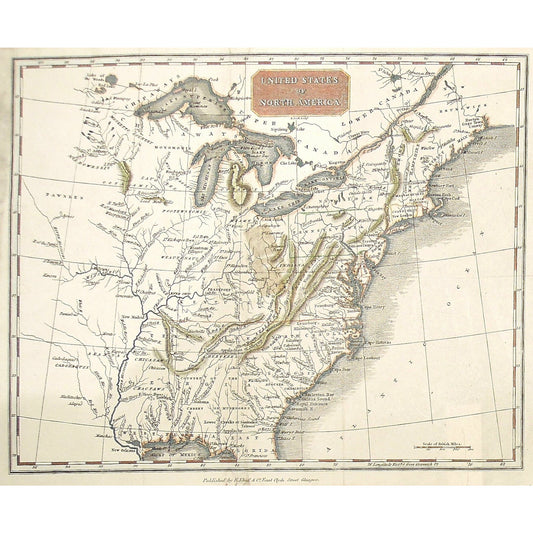
United States of North America. (S3-39)
Regular price $150.00 USDRegular price -
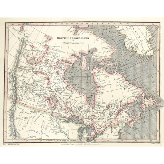
British Possessions in North America. (S3-38)
Regular price $160.00 USDRegular price