-
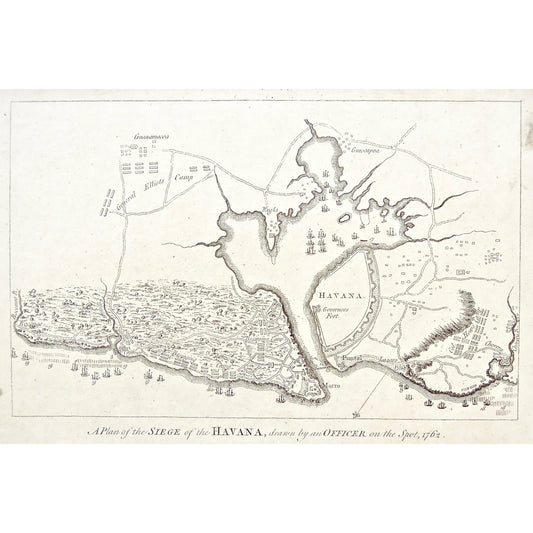
A Plan of the Siege of the Havana, drawn by an Officer on the Spot, 1762. (S3-79)
Regular price $160.00 USDRegular price -
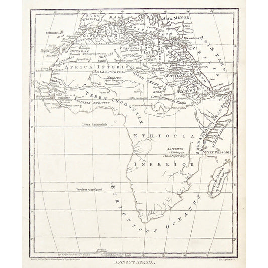
Ancient Africa. (S3-78)
Regular price $325.00 USDRegular price -
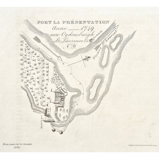
Fort La Présentation. Anno __1749 now Ogdensburgh St. Laurence Co. N.Y. (S3-77)
Regular price $120.00 USDRegular price -
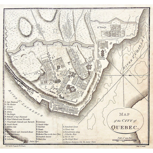
Map of the City of Quebec. (S3-76)
Regular price $120.00 USDRegular price -
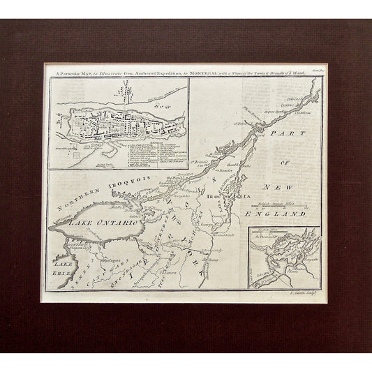
A Particular Map, to Illustrate Gen. Amherst's Expedition, to Montreal, with a Plan of the Town & Draught of ye Island. (S3-75b)
Regular price $450.00 USDRegular price -
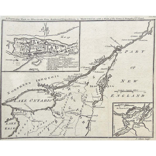
A Particular Map, to Illustrate Gen. Amherst's Expedition, to Montreal, with a Plan of the Town & Draught of ye Island. (S3-75a)
Regular price $450.00 USDRegular price -
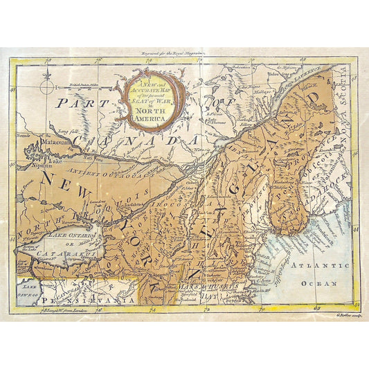
Seat of War in North America. (S3-73)
Regular price $180.00 USDRegular price -
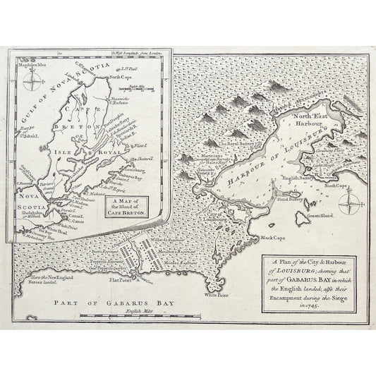
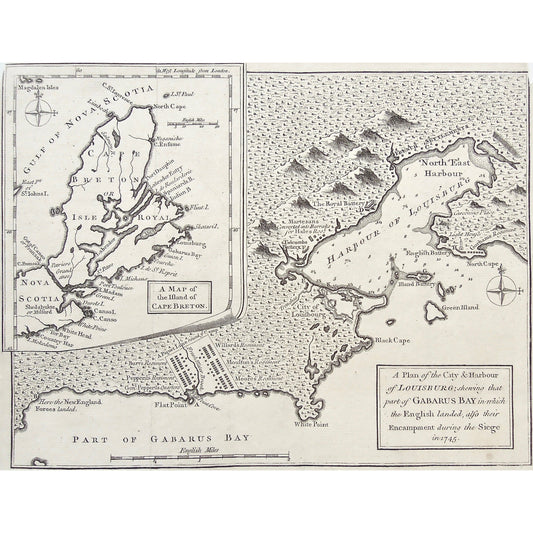
A Plan of the City & Harbour of Louisburg Shewing that Part of Gabarus Bay in Which the English Landed. also Their Encampment during the Siege in 1745. Inset: A Map of the Island of Cape Breton. (S3-72b)
Regular price $320.00 USDRegular price -
A Plan of the City & Harbour of Louisburg Shewing that Part of Gabarus Bay in Which the English Landed. also Their Encampment during the Siege in 1745. Inset: A Map of the Island of Cape Breton. (S3-72a)
Regular price $280.00 USDRegular price -
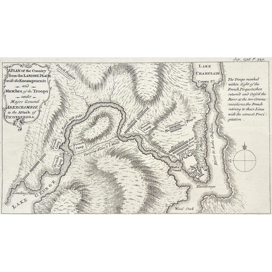
A Plan of the Country from the Landing Place with the Encampments and Marches of the Troops under Major General Abercrombie to the Attack of Ticonderoga. (S3-71)
Regular price $320.00 USDRegular price -
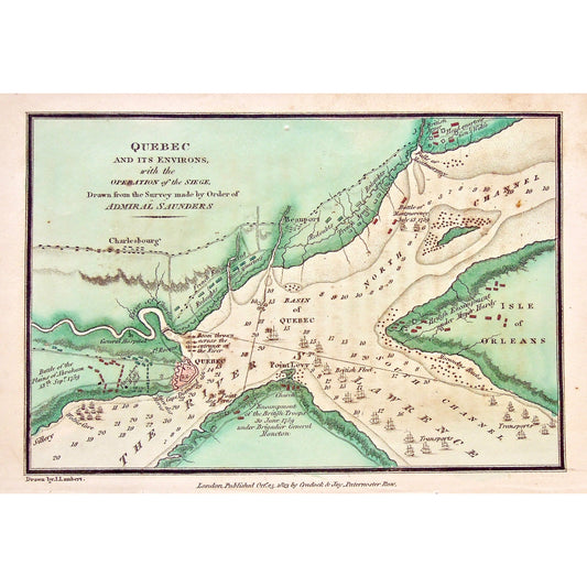
Quebec and its environs, with the Operation of the Siege. Drawn from the Survey made by Order of Admiral Saunders. (S3-70)
Regular price $150.00 USDRegular price -
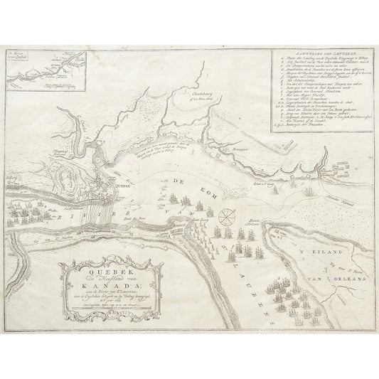
Quebeck, De Hoofdstad van Kanada; aan de River van St. Laurens door de Engelschen belegero en by Verdrag demagtigd in't jaar 1759. (S3-69)
Regular price $520.00 USDRegular price -
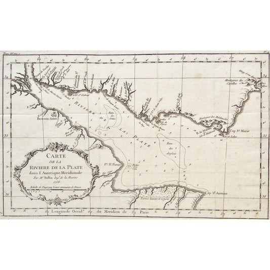
Carte de la Rivière de la Plate dans l'Amérique Meridionale. Par Mr. Bellin Ingr. De la Marine. 1756. (S3-68)
Regular price $225.00 USDRegular price -
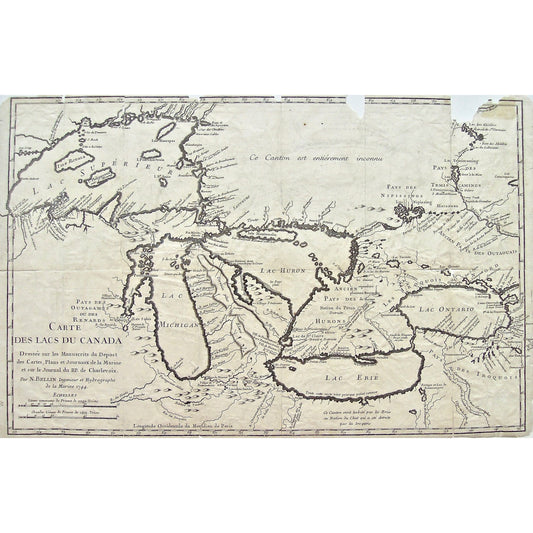
Carte des Lacs du Canada. Dressée sur les Manuscrits du Depost des Cartes, Plans et Journaux de la Marine et sur le Journal du RP. de Charlevoix. Par N. Bellin Ingenieur et Hydrographe de la Marine 1744.(S3-67)
Regular price $850.00 USDRegular price -
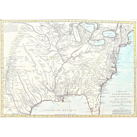
Carte de la Louisiane cours du Mississipi et pais voisins. Dediée à M. le Comte de Maurepas, Ministre et Secretaire de État Commandeur des Ordres du Roy. Par N. Bellin, Ingenieur de la Marine, 1744. (S3-66)
Regular price $1,800.00 USDRegular price -
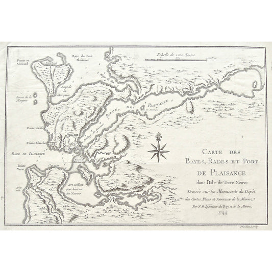
Carte des Bayes, Rades et Port de Plaisance dans l'Isle de Terre Neuve. Dressée sur les Manuscrits du Dépôt des Cartes, Plans, et Journaux de la Marine. Par N.B. Ingénieur du Roy et de la Marine, 1744. (S3-65b)
Regular price $380.00 USDRegular price