NaN
/
of
-Infinity
Victoria Cooper Antique Prints
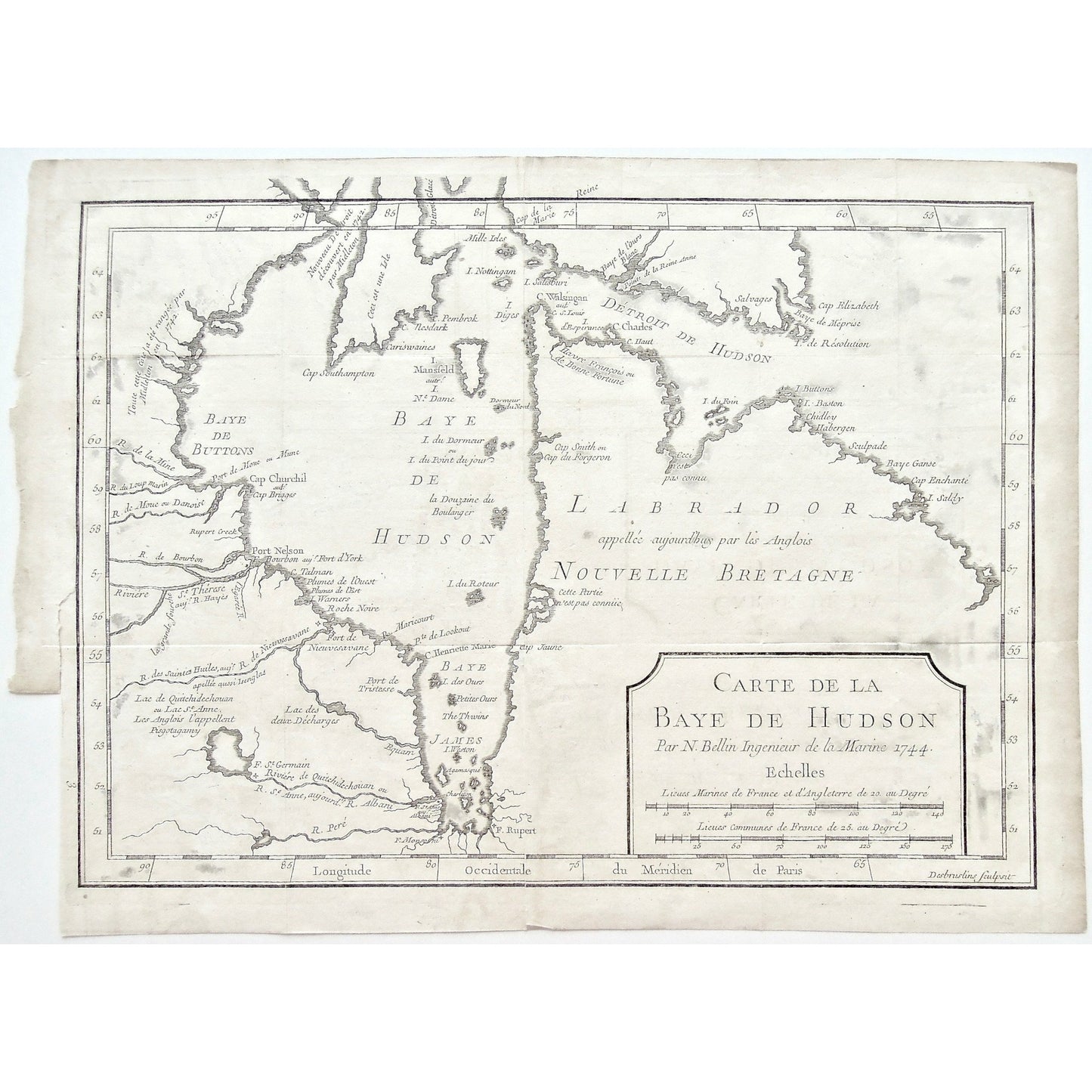
Carte de la Baye de Hudson. Par N. Bellin Ingenieur de la Marine. 1744. (S3-62a)
Carte de la Baye de Hudson. Par N. Bellin Ingenieur de la Marine. 1744. (S3-62a)
Regular price
$325.00 USD
Regular price
Sale price
$325.00 USD
Unit price
/
per
Couldn't load pickup availability
Carte de la Baye de Hudson. Par N. Bellin Ingenieur de la Marine. 1744.
Lower Left: 3. Desbruslins Sculpsit.
Author: Pierre François Xavier de Charlevoix (1682-1761)
Source / Publication: Histoire et Description Generale de la Nouvelle France avec Le Journal Historique d'un Voyage fait par Ordre du Roi dans L'Amérique Septentrionnale.
Publisher: Chez Rollin Fils
Place of Publication: Quai des Augustins, à Saint Athanase, & au Palmier, Paris
Date: 1744
Volume: 1
Page Number: Between 472-473
Artist: Jacques-Nicolas Bellin (1703-1772)
Engraver: Desbruslins
Paper Dimensions: 9 1/4 x 12 3/4 inches.
Platemark Dimensions: 9 x 11 inches.
Medium: Copper engraving
Language: French
Coloured: Black and white
Condition: The map is in overall good condition with some wear around the edges, including a tear into the bottom of the map, along the crease mark; as well as a tear into the left side of the map, where the side is also uneven, as can be seen. There also appears to be some sort of grey spotting on the map, which may have been old ink leaks, but unsure of the culprit, which can also be seen.
Keywords: Carte, Cartes, Carte de la Baye De Hudson, Hudson Bay, Hudson's Bay, Baye D'Hudson, Carte de la Baye d'Hudson, Labrador, Nouvelle Bretagne, New England, Detroit de Hudson, Baye de Hudson, James Bay, James' Bay, Baye James, Fort Rupert, Baye de Buttons, Isle Mansfield, Mansfield Island, Cap Elizabeth, Cape Elizabeth, Cap Southampton, Cape Southampton, Cap Churchill, Cape Churchill, Mille Isles, Desbruslins, Nicolas Bellin, Bellin, Jacques Nicolas Bellin, Marine Engineer, Ingenieur de la Marine, 1744, Charlevoix, Map, Maps, Mapping, Chart, Charts, Charting,
Price: US$325
Identification Number: S3-62a


