1
/
of
2
Victoria Cooper Antique Prints
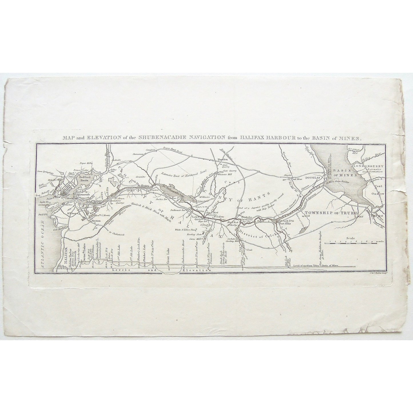
Map and Elevation of the Shubenacadie Navigation from Halifax Harbour to the Basin of Mines. (S3-40b)
Map and Elevation of the Shubenacadie Navigation from Halifax Harbour to the Basin of Mines. (S3-40b)
Regular price
$140.00 USD
Regular price
Sale price
$140.00 USD
Quantity
Couldn't load pickup availability
Map and Elevation of the Shubenacadie Navigation from Halifax Harbour to the Basin of Mines.
Lower Right: J.&C.Walker sculpt.
Publisher: W. Faden
Place of Publication: London
Date: 1830
Engraver: J. & C. Walker
Paper Dimensions: 9 x 14 inches.
Platemark Dimensions: 5 3/8 x 12 1/4 inches.
Medium: Copper engraving
Language: English
Coloured: Black and White
Condition: The print is in good condition; however, the paper is torn around the platemark area, on the bottom left of the print, there is also wear around the edges of the print, as can be seen.
Keywords: Map, Elevation, Shubenacadie, Navigation, Halifax, Harbour, Basin, Mines, Basin of mines, County of Hantes, Township of Truro, Truro, Hantes, District of Colchester, Colchester, County of Halifax, Halifax, Bedford Basin, Halifax Harbour, Douglas, Londonderry, Dartmouth, Preston, Levels, Paper Mill, Granite, Birch, Hardwood, Coal Mine, Fort Elhs, Black Rock, Limestone, Gypsum, Rock, Stone, Dalhousie Inn, Shultz's Inn, Rawden, Faden, Walker, London, 1830, Copper engraving, Antique print, Maps, Mapping, Chart, Charts, charting,
Price: US$140
Identification Number: S3-40b
Share