1
/
of
2
Victoria Cooper Antique Prints
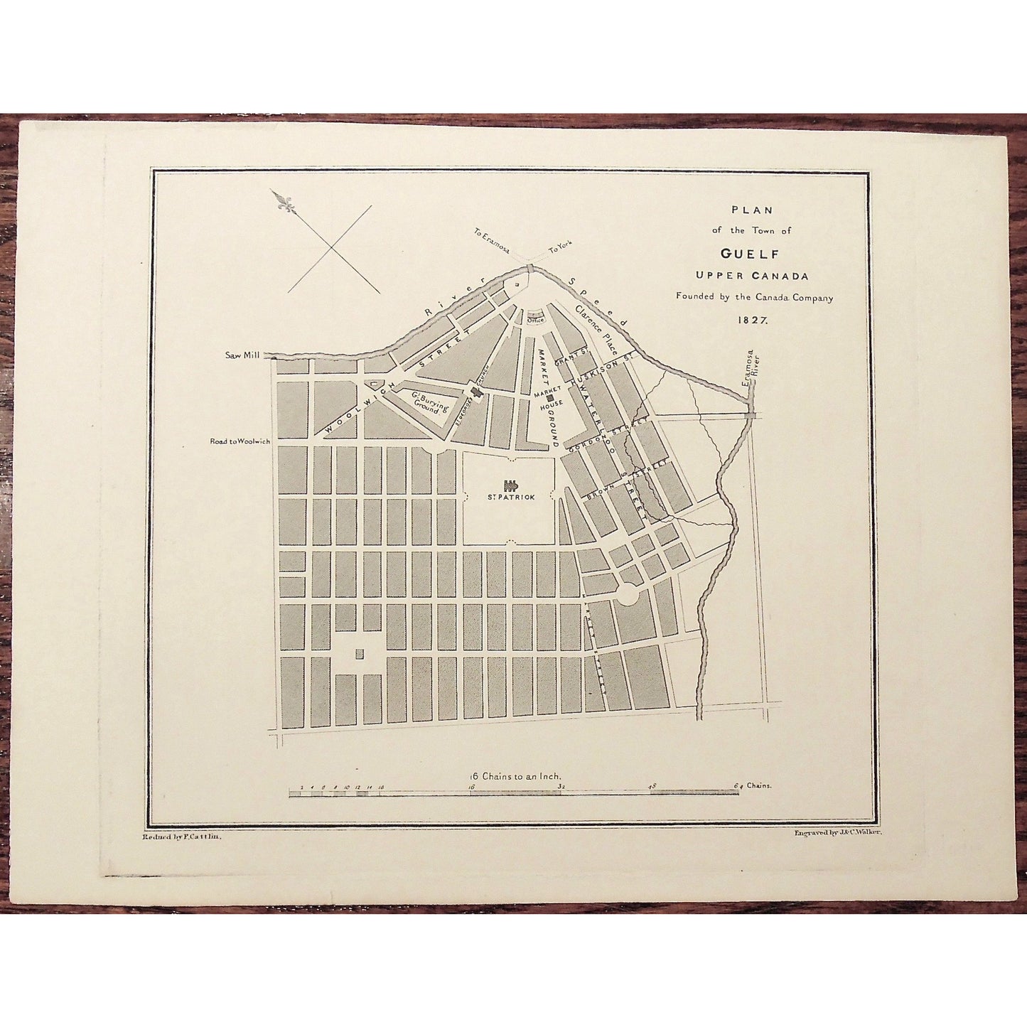
Plan of the Town of Guelf Upper Canada Founded by the Canada Company. 1827. (S3-33b)
Plan of the Town of Guelf Upper Canada Founded by the Canada Company. 1827. (S3-33b)
Regular price
$250.00 USD
Regular price
Sale price
$250.00 USD
Quantity
Couldn't load pickup availability
Plan of the Town of Guelf Upper Canada Founded by the Canada Company. 1827.
Lower Left: Reduced by F.Cattlin. Lower Right: Engraved by J. & C. Walker.
Author: Joseph Bouchette Esq. (1774-1841)
Source / Publication: The British Dominions in North America; or a Topographical and Statistical Description of the Provinces of Lower and Upper Canada, New Brunswick, Nova Scotia, The Island of Newfoundland, Prince Edward, and Cape Breton, including considerations of Land-granting and Emigration, and a Topographical Dictionary of Lower Canada; to which are annexed, the Statistical Tables and Tables of Distances, published, with the Author's Topographical Maps of Lower Canada, in consequence of a Vote of the Provincial Legislature.
Publisher: Longman, Rees, Orme, Brown, and Green
Place of Publication: Paternoster Row, London
Date: 1831
Date (Depicted): 1827
Engraver: J. & C. Walker, Reduced by F. Cattlin.
Paper Dimensions: 8 5/8 x 11 1/8 inches.
Platemark Dimensions: 8 3/8 x 9 inches.
Medium: Steel engraving
Language: English
Coloured: Black and White
Condition: The print is in excellent condition with very minor wear around the edges, beyond the platemark, as can be seen.
Keywords: Guelf, Upper Canada, Ontario, Canada Company, St. Patrick's Square, Market House, Market, Market Grounds, Burying Ground, Clarence Place, River Speed, Speed River, Bouchette, Jos. Bouchette, Joseph Bouchette, Cattlin, Walker, British Dominions in North America,
Price: US$250
Identification Number: S3-33b
Share


